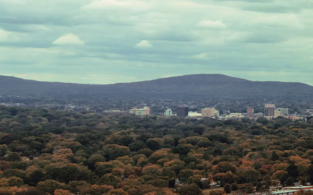
Huntsville's 12 main areas, from downtown to Hampton Cove and the Limestone County side, with ZIP codes, zoned high schools and home values.
Last checked Oct. 17, 2026. Sources: the City of Huntsville’s address and school zone data, historic districts page, Downtown Master Plan Update (PDF), neighborhood associations list and news releases; the Alabama State Department of Education’s state report card for 2025; Zillow Research; the Census Bureau; and OpenStreetMap.
Huntsville is a city of 222,791 people, according to the Census Bureau’s 2020-2024 American Community Survey five-year estimates, and it covers a lot of ground. Interstate 565 runs east from I-65 to downtown, Memorial Parkway (U.S. 231/431) runs north to south through the middle, and University Drive (U.S. 72) heads west toward Madison. Redstone Arsenal fills the southwest, and Monte Sano rises on the east, with Hampton Cove on the far side of the mountain.
The city’s address data held 159,821 address points inside city limits on Oct. 17, 2026: 154,102 in Madison County, 5,691 in Limestone County and a few dozen in Morgan and Marshall counties. Three things to know before you look at a listing:
- The mailing city is not the city. 18% of Huntsville addresses carry another town’s mailing city: Madison (14,167), Owens Cross Roads (9,558), Harvest, Gurley, Brownsboro and others. A “Madison, AL” address can be inside Huntsville, and a “Huntsville, AL” address can be in unincorporated Madison County. Check the city on the parcel with the Madison County or Limestone County property search.
- School zones follow the city line. In the city’s data every address inside Huntsville is zoned for Huntsville City Schools, including the Limestone County part, and no address outside is. Homes outside the city are usually in Madison County Schools, Madison City Schools or Limestone County Schools. Check any address with the city’s School Zone Locator.
- Five high school zones. Columbia High serves 34% of city addresses, Huntsville High 24%, Grissom High 21%, Lee High 11% and Jemison High 10%.
The areas at a glance
Home values are the Zillow Home Value Index for September 2026: a modeled typical value for the middle third of homes in the whole ZIP code, not a sale price. The citywide figure was $286,952. High school shares are of each area’s addresses in the city’s data; 2025 scores are from the state report card.
| Area | Main ZIP codes | Zoned high school | Typical value, main ZIP |
|---|---|---|---|
| Downtown, Twickenham and Old Town | 35801 | Huntsville (100%) | $393,739 |
| Five Points and Blossomwood | 35801 | Huntsville (100%) | $393,739 |
| Monte Sano | 35801, 35741 | Huntsville (100%) | $393,739 |
| Jones Valley | 35801, 35802 | Huntsville (100%) | $393,739 |
| South Huntsville | 35803, 35802 | Grissom (100%) | $318,684 |
| Hampton Cove | 35763 | Huntsville (100%) | $444,412 |
| North Huntsville | 35811, 35801 | Lee (100%) | $286,997 |
| Northwest Huntsville | 35810 | Jemison (100%) | $167,004 |
| West Huntsville and Lowe Mill | 35805 | Columbia (64%), Grissom, Huntsville | $150,455 |
| University Drive and MidCity | 35816, 35806 | Huntsville (65%), Columbia | $158,100 |
| Highway 72 West | 35806, 35757 | Columbia (100%) | $365,309 |
| Zierdt Road and the Limestone County side | 35824, 35756 | Columbia (100%) | $388,515 |
The five zoned high schools’ 2025 state report card scores were Huntsville 90 (A), Lee 83 (B), Grissom 77 (C), Columbia 71 (C) and Jemison 69 (D). See each area’s page for its elementary and middle schools.
Map of the areas
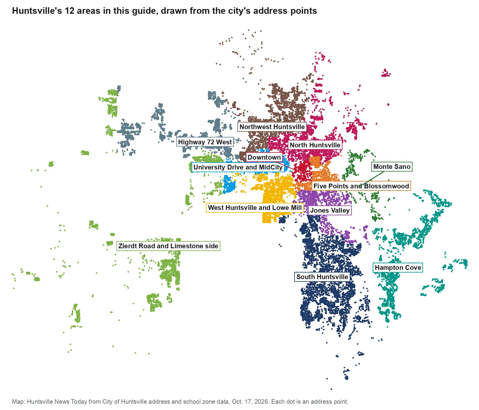
Map: Huntsville News Today from the City of Huntsville’s address and school zone data, Oct. 17, 2026. Each dot is an address point.
The areas
Downtown, Twickenham and Old Town. The city’s own Downtown area: the courthouse square, Big Spring Park and City Hall, with Twickenham, Huntsville’s first historic district, and Old Town’s Victorian streets. All ZIP 35801, all Huntsville High.
Five Points and Blossomwood. East of downtown, from the Five Points historic district on Pratt Avenue south through Blossomwood to Huntsville High and Maple Hill Park. Zoned for Blossomwood Elementary and Huntsville High.
Monte Sano. The mountain on the city’s eastern edge, beside Monte Sano State Park and the Monte Sano Nature Preserve. Monte Sano Elementary scored 100 in 2025.
Jones Valley. Southeast of downtown along Whitesburg Drive, Airport Road and Four Mile Post Road, with John Hunt Park and Jones Farm Park.
South Huntsville. The largest area here, from Whitesburg and Weatherly Heights to Bailey Cove, Hays Farm and Farley, all zoned for Grissom High, with a 17-mile greenway loop.
Hampton Cove. Over Monte Sano on U.S. 431, mostly ZIP 35763, zoned for Hampton Cove Middle and Huntsville High. ZIP 35763 also takes in Owens Cross Roads and county land.
North Huntsville. Up Meridian Street to Alabama A&M and east along Oakwood Avenue, with the Edmonton Heights and Dallas Mill Village historic districts. Zoned for Lee High.
Northwest Huntsville. Pulaski Pike, Mastin Lake Road and Lakewood, with Stoner Park, Legacy Park and two magnet academies. Zoned for Jemison High.
West Huntsville and Lowe Mill. The ZIP 35805 mill neighborhoods west of Memorial Parkway, with Lowe Mill, Merrimack, Brahan Spring Park and the Mill Creek redevelopment. Split among three high school zones.
University Drive and MidCity. Terry Heights, McThornmor Acres and UAH’s north campus west to the MidCity District and Apollo Park.
Highway 72 West. Subdivisions along U.S. 72 north of Cummings Research Park, a third of them with Madison mailing ZIP codes. Zoned for Columbia High.
Zierdt Road and the Limestone County side. The city’s western corridor, from Zierdt Road and Bridge Street Town Centre into Limestone County, where the city plans for thousands of new homes. Zoned for Columbia High.
Comparing Huntsville with Madison
Taxes, schools, home values and commutes for Huntsville and its neighbor Madison side by side: Huntsville vs Madison. For the citywide market, see our home prices guide; for enrollment, report cards and the board, our schools guide. Getting set up: moving here and property taxes.
How we built this
We named only areas a public source places on a map. The sources were:
- The city’s own geography. The Downtown area and the Hays Farm area in the city’s address data, the Downtown Master Plan Update (PDF), the city’s historic districts (Twickenham, Old Town, Five Points and Alabama A&M), its neighborhood associations list, the Mill Creek and North Huntsville Greenway pages, and city news releases that use the names northwest Huntsville, west Huntsville, South Huntsville, Hampton Cove and MidCity.
- School zones. Where the city has no formal boundary, we drew each area from whole Huntsville City Schools elementary zones in the city’s address data, so every school figure on these pages is exact for the area as drawn.
- OpenStreetMap place names, such as Lily Flagg, Weatherly Heights, Edmonton Heights, Normal, Terry Heights and Greenbrier, to describe what is inside each area.
The city does not publish a homeowners association registry, so these pages list only the neighborhood associations on the city’s list. Area edges follow school zones and ZIP codes, not streets, and are approximate; the School Zone Locator and the county property records are the authority for any one address. Place and store data are © OpenStreetMap contributors.
Frequently asked questions
What are the neighborhoods in Huntsville, Alabama?
Our guide covers 12 areas: Downtown with Twickenham and Old Town, Five Points and Blossomwood, Monte Sano, Jones Valley, South Huntsville, Hampton Cove, North Huntsville, Northwest Huntsville, West Huntsville and Lowe Mill, University Drive and MidCity, Highway 72 West, and Zierdt Road and the Limestone County side.
What ZIP codes are in Huntsville?
Huntsville addresses use 26 ZIP codes in the city’s data. Most are 35801 to 35806, 35810, 35811, 35816 and 35824; Hampton Cove is mostly 35763, and many western addresses use 35756, 35757 or 35758, which carry a Madison mailing address.
Do Huntsville school zones follow city limits?
In the city’s address data, every address inside Huntsville city limits, including the Limestone County part, is zoned for Huntsville City Schools, and no address outside is. A Huntsville mailing address does not mean you are inside the city.
Which high schools serve Huntsville neighborhoods?
Five zoned high schools: Columbia (34% of city addresses), Huntsville (24%), Grissom (21%), Lee (11%) and Jemison (10%), the city’s school zone data shows.
What is the typical home value in Huntsville?
$286,952 in September 2026, according to the Zillow Home Value Index. By ZIP code it ranged from $150,455 in 35805 to $444,412 in 35763, which covers Hampton Cove.
Have your say