South Huntsville, from Whitesburg to Bailey Cove and Farley, is zoned for Grissom High. Zillow put ZIP 35803 at $318,684 in September 2026.
Last checked Oct. 17, 2026. Sources: the City of Huntsville’s address and school zone data, parks layer, news releases and Orbit schedule data; the Alabama State Department of Education’s state report card for 2025; Zillow Research; and OpenStreetMap.
South Huntsville is the city’s largest residential area in this guide: the long stretch of subdivisions, apartments and shopping centers south of Airport Road, between Redstone Arsenal on the west and the wooded ridges on the east, down to the Tennessee River. Memorial Parkway, Whitesburg Drive and Bailey Cove Road are its main north-south roads. Every address in it is zoned for Grissom High.
What this means for you
- Zoned high school: Virgil I. Grissom High, for every address in the area (2025 state report card: 77, a C).
- Home value: $318,684 in ZIP 35803 and $358,652 in ZIP 35802 in September 2026, according to the Zillow Home Value Index.
- Nearest interstate exit: none close. I-565 exit 20 is about 8.7 miles by road; most drivers use Memorial Parkway north.
Part of our Huntsville neighborhoods guide.
Where it is
On this page South Huntsville is the six elementary school zones that feed Grissom High in the city’s data: Whitesburg, Roger B. Chaffee, Weatherly Heights, Mountain Gap, Challenger and Farley. On Oct. 17, 2026, they held 29,489 address points, all inside city limits: 56% in ZIP code 35803, 42% in 35802 and 2% in 35805. The city provides police, fire and garbage service.
The parts, by elementary zone, with places OpenStreetMap names in each:
| Elementary zone | Addresses | Main ZIP code | Places named |
|---|---|---|---|
| Whitesburg | 6,468 | 35802 | Lily Flagg, Bel Air Estates, Flemington Heights, Fleming Meadows |
| Roger B. Chaffee | 5,827 | 35802, 35803 | Byrd Springs, English Village, Whitesburg Estates, Haysland Estates |
| Weatherly Heights | 5,286 | 35802, 35803 | Weatherly Heights, Willowbrook, Sugar Tree |
| Mountain Gap | 3,435 | 35803 | Mountain Gap Estates, Woodridge, Camelot |
| Challenger | 5,325 | 35803 | Farley, South Gate, Fox Run |
| Farley | 3,148 | 35803 | Green Cove Meadows, Redstone Park |
Hays Farm is one of only two named geographic areas, with Downtown, in the city’s address data: 391 addresses, all in the Chaffee zone. The 850-acre Hays Farm development across from Grissom High includes a planned nine-acre community green, the city said in January 2020, and The Market at Hays Farm, with a Publix, replaced the former Haysland Square shopping center on South Memorial Parkway, according to a city release from August 2020.
Schools
Scores are each school’s overall 2025 score on the state report card (the 2024-25 school year). Shares are of the area’s addresses in the city’s data and are rounded.
| Level | School | Share of addresses | 2025 score (grade) |
|---|---|---|---|
| High | Virgil I. Grissom High | 100% | 77 (C) |
| Middle | Whitesburg Middle (Whitesburg and Chaffee zones) | 42% | 66 (D) |
| Middle | Mountain Gap Middle (Weatherly Heights and Mountain Gap zones) | 30% | 93 (A) |
| Middle | Challenger Middle (Challenger and Farley zones) | 29% | 91 (A) |
| Elementary | Whitesburg Elementary | 22% | 86 (B) |
| Elementary | Roger B. Chaffee Elementary | 20% | 93 (A) |
| Elementary | Challenger Elementary | 18% | 89 (B) |
| Elementary | Weatherly Heights Elementary | 18% | 93 (A) |
| Elementary | Mountain Gap Elementary | 12% | 99 (A) |
| Elementary | Farley Elementary | 11% | 92 (A) |
Check one address with the city’s School Zone Locator. More in our schools guide.
Home values
According to the Zillow Home Value Index:
| ZIP code | Share of area addresses | Typical value, September 2026 | Change from September 2025 |
|---|---|---|---|
| 35803 | 56% | $318,684 | +1.6% |
| 35802 | 42% | $358,652 | +2.1% |
The index is a modeled typical value for the middle third of homes, not a sale price. 35802 also covers part of Jones Valley. The citywide figure was $286,952, up 1.4%. More in our home prices guide.
Parks and trails
A 1.5-mile Tennessee River Greenway addition from Redstone Road to Green Cove Road completed a continuous 17-mile South Huntsville Greenway Loop, including the Aldridge Creek Greenway and Ditto Landing, the city said July 29, 2026. From the city’s parks layer:
- Ditto Landing, 293 Ditto Landing Road SE, a Madison County park on the Tennessee River.
- Sandra Moon Community Complex, 7901 Bailey Cove Road SE, home of the South Huntsville Public Library, which opened in September 2021.
- Southside Park, 15935 Chaney Thompson Road SE, with a walking path and playground.
- McGucken Park, 13020 Bailey Cove Road SE, with a playground.
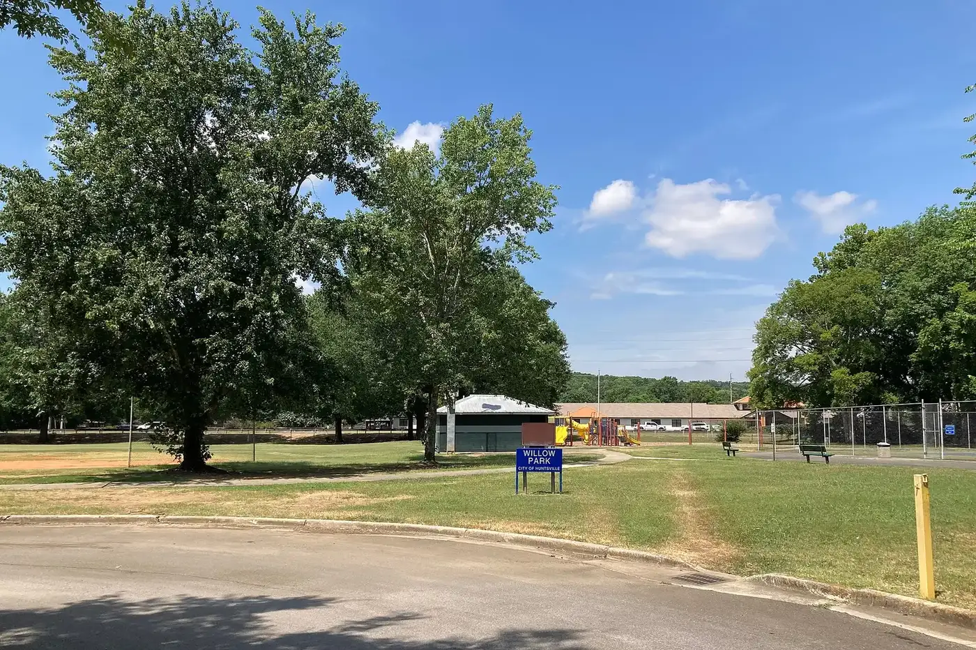
- Willow Park, 1928 Aftonbrae Drive SE, and Ken Johnston Park, 1100 Mountain Gap Road SE, both with playgrounds.
- Blevins Gap Nature Preserve, 4100 Cecil Ashburn Drive SE, Land Trust of North Alabama land with trails on the mountain to the east.
More in our walking and biking trails guide.
Getting around
- Memorial Parkway is the main route north to downtown and I-565. I-565 exit 20 is about 8.7 miles by road from the middle of the area, using the exit numbers mapped in OpenStreetMap.
- Downtown: about 7.4 miles by road to City Hall, 305 Fountain Circle.
- Airport: about 19 miles to Huntsville International Airport. Distances are measured on the OpenStreetMap road network with the OSRM routing engine; they are distances, not drive times.
- Orbit buses: route 56 (Bailey Cove), which the city describes as a South Huntsville horseshoe, stops along Memorial Parkway, Bailey Cove Road and the library; route 5 (Byrd Spring) serves Golf Road and Byrd Spring Road; route 6 (Jones Valley) reaches the north edge, according to the city’s schedule data.
More in our getting around guide.
Neighborhood associations
The city’s neighborhood associations list includes the Chaffee Community Civic Association (fourth Monday, 6:30 p.m., Community Baptist Church, Logan Drive), the English Village Civic Association, the Farley Community Neighborhood (first Tuesday, South Precinct), the Fleming Meadows/Westbury Estates Civic Association and Whitesburg Estates. The city does not publish a list of homeowners associations.
Groceries and everyday stores
From OpenStreetMap:
- Publix, 9040 Memorial Parkway SW and 12796 Bailey Cove Road SE.
- Kroger, 8404 Memorial Parkway SW; Walmart Supercenter, 11610 Memorial Parkway SW; Walmart Neighborhood Market, 9020 Bailey Cove Road SE; ALDI, 11909 S. Memorial Parkway.
- CVS Pharmacy, 11030 Memorial Parkway SW, and Walgreens, 11399 Memorial Parkway SW.
How we drew this area
The area is the six elementary zones that feed Grissom High in the city’s school zone data. School zones and ZIP codes come from every address point in them, checked Oct. 17, 2026. Place and store locations are © OpenStreetMap contributors.
Frequently asked questions
What high school is South Huntsville zoned for?
Virgil I. Grissom High, 1001 Haysland Road, for every address in the six South Huntsville elementary zones in the city’s data. Grissom scored 77, a C, on the 2025 state report card.
What ZIP codes are in South Huntsville?
Mostly 35803 (56% of addresses) and 35802 (42%). Zillow put the typical home value at $318,684 in 35803 and $358,652 in 35802 in September 2026.
How long is the South Huntsville greenway loop?
17 miles. A 1.5-mile Tennessee River Greenway addition from Redstone Road to Green Cove Road completed the continuous loop, the city said on July 29, 2026.
Where is the South Huntsville library?
At the Sandra Moon Community Complex, 7901 Bailey Cove Road SE. The 30,750-square-foot South Huntsville Public Library opened in September 2021, replacing the Bailey Cove branch.
Is South Huntsville a good place to live?
Here are the facts. South Huntsville has about 29,490 address points, the 17-mile greenway loop, Ditto Landing and the Sandra Moon Community Complex, and is zoned for Grissom High (77 on the 2025 state report card); it is about 7 miles by road from City Hall.
Have your say