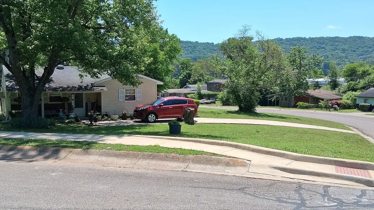
North Huntsville, from the mill villages to Alabama A&M, is zoned for Lee High and is mostly ZIP 35811. Zillow: $286,997 in September 2026.
Last checked Oct. 17, 2026. Sources: the City of Huntsville’s address and school zone data, North Huntsville Greenway page, historic districts page, parks layer and Orbit schedule data; the Alabama State Department of Education’s state report card for 2025; Zillow Research; and OpenStreetMap.
North Huntsville runs from the old mill villages just north of downtown up Meridian Street and Andrew Jackson Way to Alabama A&M University in Normal, and east along Oakwood Avenue and Winchester Road toward Chapman Mountain. It takes in mill villages, three historic districts, newer subdivisions and the university campus.
What this means for you
- Zoned high school: Lee High, for every address in the area (2025 state report card: 83, a B).
- Home value: $286,997 in ZIP 35811 in September 2026, according to the Zillow Home Value Index.
- Nearest interstate exit: I-565 exit 19 (Memorial Parkway, Pratt Avenue and Washington Street), about 1.2 miles by road.
Part of our Huntsville neighborhoods guide.
Where it is
On this page North Huntsville is the Lee High zone: the Martin Luther King Jr. and Montview elementary zones and the part of the Blossomwood Elementary zone that feeds Lee. On Oct. 17, 2026, the city’s data held 16,833 address points in it, all inside city limits: 53% in ZIP code 35811, 26% in 35801 and 18% in 35810. The city provides police, fire and garbage service.
Places OpenStreetMap names inside the area include Normal, around Alabama A&M; Edmonton Heights; Chapman Heights and Darwin Downs to the east; Lincoln and Dallas, the old mill villages north of downtown; and Colonial Hills, Bellemeade and Oak Park. Historic districts here include the city-designated Alabama A&M University district, whose campus buildings date mostly from 1927 to 1962, the city says, and the National Register-listed Edmonton Heights and Dallas Mill Village districts mapped in OpenStreetMap. A small slice of the city’s Five Points district, 18 addresses, is zoned for Lee as well.
North Huntsville Greenway. The city is planning a greenway along Pinhook Creek to connect downtown with Alabama A&M, drawing on the Atlanta BeltLine, according to its project page. Public workshops were held in July and August 2025.
Schools
Scores are each school’s overall 2025 score on the state report card (the 2024-25 school year). Shares are of the area’s addresses in the city’s data.
| Level | School | Share of addresses | 2025 score (grade) |
|---|---|---|---|
| High | Lee High, 2500 Meridian St. | 100% | 83 (B) |
| Middle | Chapman Middle, 2006 Reuben Drive | 100% | 73 (C) |
| Elementary | Martin Luther King Jr. Elementary, 3112 Meridian St. N. | 47% | 71 (C) |
| Elementary | Blossomwood Elementary | 35% | 88 (B) |
| Elementary | Montview Elementary, 2600 Garvin Road NW | 18% | 79 (C) |
New Century Technology High, a district magnet school that shares Lee’s address, scored 98 (A); it is not a zoned school. See the district’s magnet programs. Check one address with the city’s School Zone Locator. More in our schools guide.
Home values
According to the Zillow Home Value Index:
| ZIP code | Share of area addresses | Typical value, September 2026 | Change from September 2025 |
|---|---|---|---|
| 35811 | 53% | $286,997 | +1.4% |
| 35801 | 26% | $393,739 | +1.8% |
| 35810 | 18% | $167,004 | -1.4% |
The index is a modeled typical value for the middle third of homes, not a sale price. 35801 also covers downtown and Five Points, and 35810 also covers most of northwest Huntsville. The citywide figure was $286,952, up 1.4%. More in our home prices guide.
Parks and trails
From the city’s parks layer:
- Optimist Park, 703 Oakwood Ave. NE, about 11 acres, with a recreation center, walking path and playground.
- Oak Park, 2250 Oakwood Ave. NE, with a walking path and playground.
- James C. Crawford Park, 3915 Melody Road NE, with a walking path and playground.
- Philpot Park, 1211 Philpot Ave. NE, and Beirne Park, 330 Beirne Ave. NE, both with walking paths and playgrounds.
More in our parks and trails guide.
Getting around
- Interstate: I-565 exit 19 (Memorial Parkway, Pratt Avenue and Washington Street), about 1.2 miles by road, or exit 20 (Oakwood Avenue and Andrew Jackson Way), about 1.8 miles, using the exit numbers and destination signs mapped in OpenStreetMap.
- Downtown: about 2.4 miles by road to City Hall, 305 Fountain Circle.
- Airport: about 15 miles to Huntsville International Airport. Distances are measured from the middle of the area on the OpenStreetMap road network with the OSRM routing engine; they are distances, not drive times.
- Orbit buses: the Huntsville Transit Center, 521 Pratt Ave., is in the area, and routes 1 through 10 start there. Route 7 (Meridian, A&M) runs up Andrew Jackson Way and Meridian Street to the university, route 8 (Blue Spring) along Blue Spring Road, route 9 (Oakwood) along Oakwood Avenue and route 10 (Pulaski Pike) along Pulaski Pike, according to the city’s schedule data.
More in our getting around guide.
Neighborhood associations
The city’s neighborhood associations list includes Edmonton Heights (second Monday) and the Northeast Huntsville Civic Association (fourth Tuesday in January, April, July, August and October, 7 p.m., Optimist Park Recreation Center). The city does not publish a list of homeowners associations.
Groceries and everyday stores
From OpenStreetMap:
- Publix, 2246 Winchester Road NE; Walmart Supercenter, 2165 Winchester Road; and Aldi, 2125 Winchester Road NE.
- Food City, 150 Old Gurley Road NE.
- CVS Pharmacy, 2525 Oakwood Ave. NW.
How we drew this area
The area is the Lee High zone in the city’s school zone data. School zones and ZIP codes come from every address point in it, checked Oct. 17, 2026. Place and store locations are © OpenStreetMap contributors.
Frequently asked questions
What high school is North Huntsville zoned for?
Lee High, 2500 Meridian St., for every address in this area in the city’s school zone data, with Chapman Middle. Lee scored 83, a B, on the 2025 state report card.
What ZIP codes are in North Huntsville?
Mostly 35811 (53% of addresses), with 35801 (26%) and 35810 (18%). Zillow put the typical value at $286,997 in 35811 in September 2026.
What is the North Huntsville Greenway?
A planned greenway along Pinhook Creek to connect downtown Huntsville with Alabama A&M University, which the city is planning with a consultant team after public workshops in July and August 2025.
Is North Huntsville a good place to live?
Here are the facts. North Huntsville has about 16,830 address points, Alabama A&M University, the Edmonton Heights and Dallas Mill Village historic districts and Optimist Park; it is zoned for Lee High (83 on the 2025 state report card) and is about 2.4 miles by road from City Hall.
Have your say